And how to make sure you’re not missing out on Google Local Guide points from Street View photos.
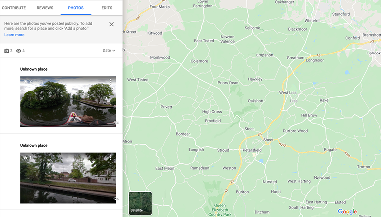
It’s because your photo has no Place ID.
Place IDs uniquely identify a place in the Google Places database and on Google Maps.
The Place ID for the UK Houses of Parliament is:
ChIJGeGDRsQEdkgRZ6FVAXOU4ds
The White House Place ID is: ChIJ37HL3ry3t4kRv3YLbdhpWXE
And the Mount Everest Place ID is: ChIJvZ69FaJU6DkRsrqrBvjcdgU
If you’re interested, you can find the Place ID of a particular location using this online tool, although it won’t have much use outside of Google.
Whilst it might not have much use outside of Google, it is an important part of Google Street View uploads.
When we started publishing photos to Street View using Google’s API we we’re just passing photo.pose information along with the photo to the Street View Publish API (latitude, longitude and altitude).
This was enough information for the photo to be published, but not enough to locate the photo to a place against the Google Places database.

Now, the place is not critical to Street View (as I mentioned, the photo will still upload), however, it is critical to Google Maps Local Guides scoring functionality. Without a Place ID your photos will show as “Unknown Location” and they will not be eligible for Local Guides points.
And we wanted our Local Guides points!
For those unaware, you can earn points by contributing content to Google Maps by becoming a Local Guide.
Every place that you review, photograph, add, edit or provide additional info for on Google Maps earns you points towards unlocking something new.
Each published GSV photo upload earns 5 points – BUT ONLY IF it is assigned to a Place in the Google Places database (using Place ID).
To do this, you need to submit photo.place (the Place ID) when uploading the photo using the Street View Publish API.
So how do you get a Place ID?
Using the Google Maps Reverse Geocoding API.
Submitting the latitude and longitude to the Geocoding API will usually return a number of place_id in the response (with lots of other information too).
For example: https://maps.googleapis.com/maps/api/geocode/json?latlng=40.714224,-73.961452&key=YOUR_API_KEY
Google will usually return a number of place_id’s for each place that matches the co-ordinates. Note, Google classifies various levels of places from buildings to cities to states (e.g the Googleplex has a place_id=ChIJj61dQgK6j4AR4GeTYWZsKWw and California has a place_id=ChIJPV4oX_65j4ARVW8IJ6IJUYs).
You can filter the response to include / exclude certain place levels. For example, passing using the result_type=locality only returns results for places at locality level (usually towns / cities).
With a Place ID now being submitted to Street View, every single Local Guide point earned should be awarded.
We're building a Street View alternative for explorers
If you'd like to be the first to receive monthly updates about the project, subscribe to our newsletter...

