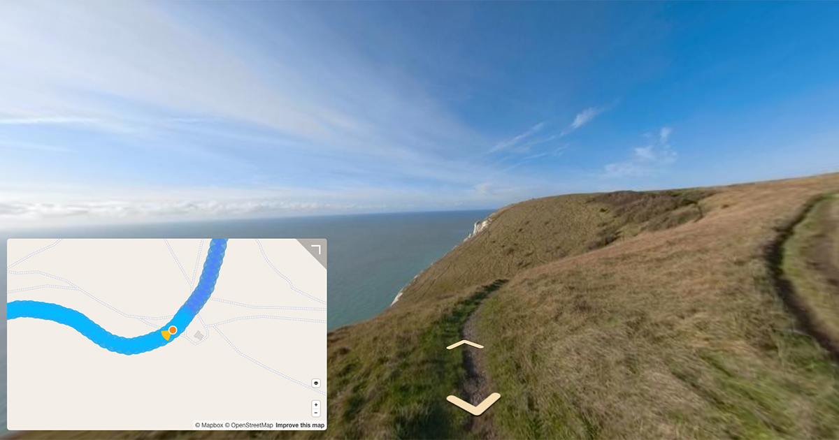
Here are my notes about the KartaView API from my research planning an integration.
Last week I took a brief look at KartaView, a street-level imagery platform.
You will have read my recent posts documenting the Google Street View Publish and Mapillary v4 API’s.
In my research of the KartaView API I’ve been exploring their documentation. This post is a short write up of what I’ve found.
Authentication is not documented in the official docs. Doing a bit of digging into their upload scripts repo on Github, you can see Facebook, Google, and OSM OAuth are supported.
    @classmethod
    def login(cls, env: OSCAPISubDomain, provider: str) -> Optional[str]:
        """this method returns login URL"""
        if provider == "google":
            return _osc_url(env) + '/auth/google/client_auth'
        if provider == "facebook":
            return _osc_url(env) + '/auth/facebook/client_auth'
        # default to OSM
        return _osc_url(env) + '/auth/openstreetmap/client_auth'
You can use the authentication token provided after authenticating as X-Auth-Token in the header of each request, as seen in the code for the API here.
The core resources of KartaView are sequence’s.
A sequence is a collection of photos captured continuously by an OpenStreetCam user.
sequences can be created using one or more photo’s and video’s.
The upload flow for an photo works like so:
- Optional.
POSTa newsequence. This will return an ID for the sequence (result.data.id). - POST a new
photoby posing the required parameters in the request, including the sequence ID returned in step one.
It appears KartaView prefers photo uploads, noting for the POST video endpoint:
Mobile clients upload imagery data as video files to optimize compression. Data will be available after processing as photos.
Usage of this resource for retrieving imagery is advisable only for debugging purposes.
KartaView processes videos to photos server side, as Street View does. So once a video is uploaded the photo objects it produces can be obtained by:
- querying the
GET /video?id=Xendpoint using theidof video provided in the upload response which returns thesequenceid - then querying the
GET /photo?sequenceId=Xendpoint using thesequenceidreturned from step one which returns all thephoto.id’s in thesequenceid - querying the
GET /photo?id=Xendpoint using theid’s’ returned from step two
Looking inside the photo object gives a good overview of what’s exposed:
{
	"status": {
	"apiCode": 600,
	"apiMessage": "The request has been processed without incidents",
	"httpCode": 200,
	"httpMessage": "Success",
	"executionTime": 0.0946
	},
		"result": {
		"data": [
			{
			"id": 112,
			"sequenceId": 213,
			"videoId": 555,
			"rawDataId": 112,
			"videoIndex": 20,
			"sequenceIndex": 1000,
			"dateAdded": "2016-04-15 23:05:32",
			"dateProcessed": "2016-04-16 09:00:45",
			"name": "16ada_56cc3645da3c9.jpeg",
			"lat": "37.649595",
			"lng": "-122.097050",
			"heading": "161.082520",
			"visibility": "private",
			"autoImgProcessingStatus": "FINISHED",
			"status": "deleted",
			"gpsAccuracy": "10.000",
			"distance": "10.000",
			"autoImgProcessingResult": "ORIGINAL",
			"matchLat": "46.781887054443360",
			"matchLng": "23.688762664794922",
			"matchSegmentId": "23.688762664794922",
			"from": "30074863",
			"to": "186970534",
			"wayId": "140474913",
			"storage": "storage1",
			"width": "2592",
			"cameraParameters": [],
			"height": "2592",
			"filepath": "2018/9/4//1286317_c3307_42f.jpg",
			"filepathLTh": "2018/9/4//1286317_c3307_42f.jpg",
			"filepathProc": "2018/9/4//1286317_c3307_42f.jpg",
			"filepathTh": "2018/9/4//1286317_c3307_42f.jpg",
			"fileurl": "http://storage9.openstreetcam.org/files/photo/2018/9/4//1286317_c3307_42f.jpg",
			"fileurlLTh": "http://storage9.openstreetcam.org/files/photo/2018/9/4/lth/1286317_c3307_42f.jpg",
			"fileurlProc": "http://storage9.openstreetcam.org/files/photo/2018/9/4/proc/1286317_c3307_42f.jpg",
			"fileurlTh": "http://storage9.openstreetcam.org/files/photo/2018/9/4/th/1286317_c3307_42f.jpg",
			"projection": "PLANE",
			"imagePartProjection": "DUAL_FISHEYE",
			"fieldOfView": "180.00",
			"shotDate": "2016-04-16 09:00:45",
			"hasObd": "0",
			"isWrapped": "1",
			"isUnwrapped": "0",
			"projectionYaw": "180",
			"wrapVersion": "1",
			"unwrapVersion": "0"
			}
		],
	"hasMoreData": false
	}
}
The photo object contains the map position, projection, dates and path to download the processed and raw images (something Mapillary removed in their v4 API).
The photo endpoint also offers DELETE and UPDATE methods, including the ability to UPDATE the payload (the actual photo file).
The DELETE and [UPDATE] methods are also exposed on the sequence endpoints.
Once you start adding content to KartaView the usermetrics endpoints might be of particular interest, allowing you to track the statistics of the imagery you’ve uploaded and where you rank amongst the KartaView community.
{
	"status": {
		"apiCode": 600,
		"apiMessage": "The request has been processed without incidents",
		"httpCode": 200,
		"httpMessage": "Success",
		"executionTime": 0.0946
		},
		"result": {
		"data": {
		"rank": "33",
		"rankWeekly": "21",
		"totalDistance": "13.06",
		"totalOBDDistance": "89.556280",
		"totalPhotos": "2746",
		"totalPoints": "521",
		"totalProcessingSequences": "11",
		"totalSequences": "30",
		"totalUploadingSequences": "135",
		"totalWaylensDistance": "89.556280",
		"totalWaylensPoints": "89.556280"
		}
	}
}
Protip for existing Mapillary contributors
We're building a Street View alternative for explorers
If you'd like to be the first to receive monthly updates about the project, subscribe to our newsletter...


